
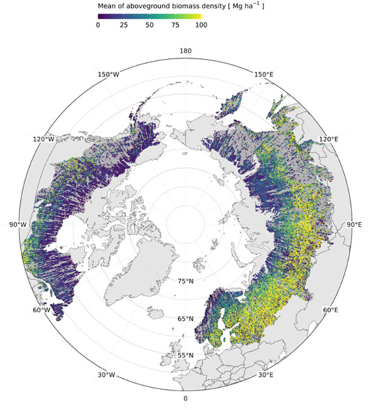
Towards global spaceborne lidar biomass: Developing and applying boreal forest biomass models for ICESat-2 laser altimetry data
Space-based laser altimetry has revolutionized our capacity to characterize terrestrial ecosystems through the direct observation of vegetation structure and the terrain beneath it. Data from NASA’s ICESat-2 mission provide the first comprehensive look at canopy structure for boreal forests from space-based lidar. The objective of this research was to create ICESat-2 aboveground biomass density (AGBD)…

Advancing Data Fusion and Research Collaboration for Global Science Initiatives
Sujen Shah will present a poster highlighting several science applications of the MAAP Platform at AGU 2023. In this presentation, we will delve into the remarkable ways in which various teams have embraced and integrated the MAAP platform, yielding significant achievements. One such success story is the SISTER SBG Pathfinder project, which has seamlessly incorporated…
Continue Reading >> Advancing Data Fusion and Research Collaboration for Global Science Initiatives
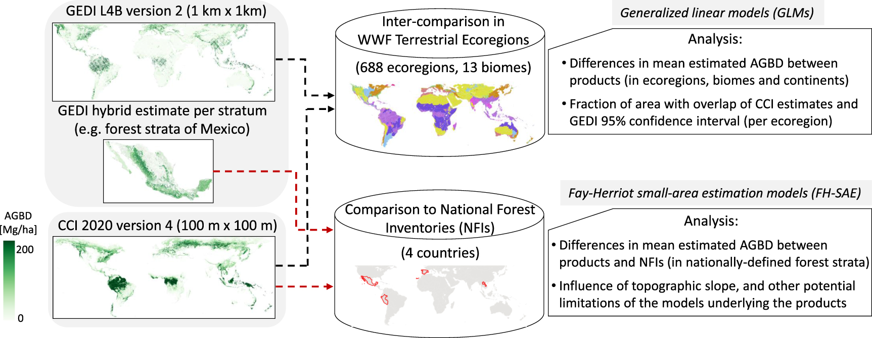
Committee of Earth Observation Satellites (CEOS) Biomass Harmonization
Biomass Harmonization is a coordinated effort of scientists to release forest-carbon estimates obtained with space data in a comparable manner. This helps identify underlying assumptions, definitions and uncertainty-estimation frameworks (Ref 1). By collaborating with scientists and policy-makers in various countries, this effort also aims to align the carbon estimates with policy guidelines, which will ease…
Continue Reading >> Committee of Earth Observation Satellites (CEOS) Biomass Harmonization