• Skip to primary navigation
  • Skip to main content
NASA MAAP

NASA MAAP

Multimission Algorithm and Analytics Platform

  • News
  • Explore
    • Science
    • Events
  • Communities
    • Github Discussions
    • ESA MAAP Home
  • Help
    • About MAAP
    • Documentation (ReadTheDocs)
    • Terms of Service
    • Open Policies
    • Bug/Feature Reports (Github)
    • MAAP Status
  • Login
    • Profile
  • Show Search
Hide Search

News

Reference Data Coming Soon

September 16, 2019

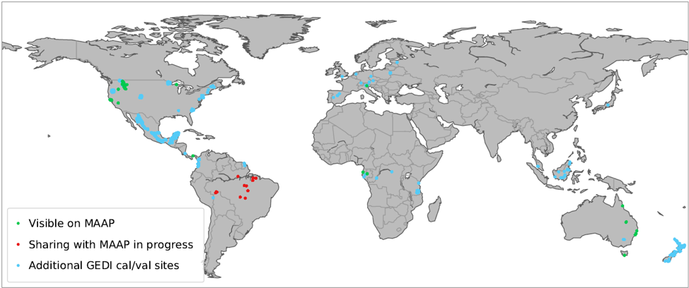
The GEDI team is continuing to expand the forest structure and biomass database with the goal of obtaining publicly available datasets that can be added to the MAAP. Some specific datasets on the horizon are:

  • Brazil field data and lidar geotiffs in the Amazon (already in the GEDI database)
  • ABoVE public field sites and airborne lidar in Alaska and Canada
  • NEON field sites and airborne lidar across the USA
  • GEDI field and airborne campaign data in Tennessee, Pacific Northwest, and Costa Rica

GEDI Cal/Val Data on the MAAP

September 16, 2019

The GEDI team has developed and curated a global field and airborne lidar database to calibrate GEDI’s empirical aboveground biomass algorithms. The publicly-available portion of this database is available on the MAAP, and newly acquired public data will be continually updated. These data are useful for multi-mission biomass calibration and validation activities. So far, the MAAP hosts 25 field datasets and 24 curated coincident lidar datasets (Table 1), which span 4 continents (Figure 1). Through GEDI processing, these datasets have undergone QA/QC activities and have a standardized data and metadata format to promote ease of comparison across locations.

Locations of datasets shared with the MAAP from the GEDI Forest Structure and Biomass Database

  • « Go to Previous Page
  • Page 1
  • Page 2

NASA MAAP

MAAP is a collaboration between ESA and NASA

  • Privacy Policy
  • Accessibility
  • ESA MAAP